


A powerful 6.5-magnitude earthquake struck off the southern Philippines on Friday evening, shaking parts of Mindanao just weeks after a devastating 7.8-magnitude quake in the same region killed dozens and caused widespread destruction.
The latest tremor struck near Sarangani in southern Mindanao, with authorities reporting no immediate casualties, damage or tsunami threat.
According to the United States Geological Survey (USGS), the earthquake struck at around 7:42pm local time (1142 GMT) at a depth of approximately 52.4 kilometres (33 miles). The USGS initially measured the quake at 6.7 magnitude before revising it to 6.5.
The epicentre was located about 35 kilometres southwest of Jose Abad Santos town in Mindanao, while other reports placed it near Sarangani, Davao Occidental, roughly 21 kilometres southwest of Sarangani town. The tremor was also felt in General Santos City, one of the largest urban centres in southern Philippines.
No tsunami warning or immediate reports of damage
Authorities said no tsunami warning was issued following the earthquake. Santa Maria town rescue official Jerson Talahig said there were no immediate reports of casualties or property damage.
"It was kind of strong, but it was quick. We saw the table and some of the lights shaking," he said.
Emergency officials continue to monitor the situation as assessments of affected areas remain underway.
Also Read: Venezuela earthquakes death toll reaches 589 as rescuers search rubble
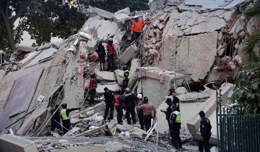
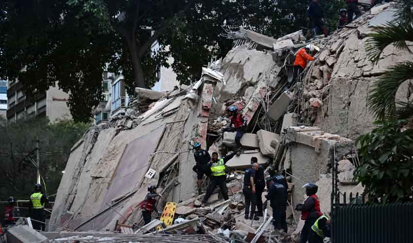
The latest quake struck less than three weeks after a powerful 7.8-magnitude earthquake hit off the coast of Sarangani province on June 8, causing widespread destruction across residential neighbourhoods and public infrastructure.
The earlier disaster killed at least 78 people, according to the latest reports, while previous assessments had placed the death toll above 60. Around 1.5 million people were affected by the catastrophe.
The June earthquake triggered landslides, damaged buildings, displaced thousands of residents and prompted tsunami warnings across the region.
Also Read: 7.8-magnitude earthquake in Philippines leaves at least 32 dead
Scientists also recorded a rare geological phenomenon known as coastal uplift, with sections of the seabed rising by about two metres (6.6 feet). The movement pushed previously submerged coral reefs above sea level and extended parts of the coastline by as much as 200 metres.
A series of strong aftershocks followed the June earthquake, including another 6.5-magnitude tremor.
Philippines remains highly vulnerable
The Philippines is among the world's most disaster-prone countries because it lies along the Pacific Ring of Fire, a 25,000-mile belt of active tectonic plate boundaries and volcanoes where around 90% of the world's earthquakes occur.
Frequent seismic activity continues to pose significant risks to communities across the archipelago, with authorities maintaining close monitoring of earthquake-prone regions.


.jpeg)