


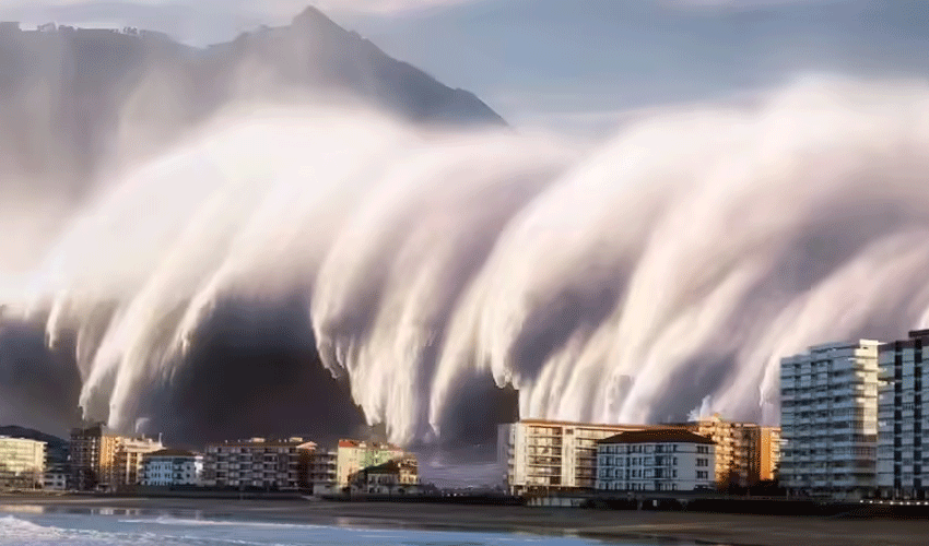
Tsunami alerts reverberated across the Pacific on Wednesday following a powerful 8.7 magnitude earthquake off Russia’s Far East coast, prompting renewed attention to one of nature’s deadliest and least predictable disasters.
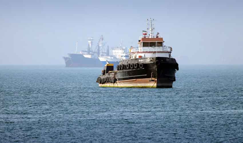
Though rare, tsunamis have the potential to obliterate coastal communities within minutes — with waves as fast as a jetliner and forces capable of lifting ships onto rooftops.
Below, we explore key facts about tsunamis, the science behind them, and the scale of damage they inflict across the globe.
What Exactly Is a Tsunami?
A tsunami — derived from the Japanese words tsu (harbour) and nami (wave) — is a massive surge of water caused primarily by undersea earthquakes. The sudden, violent movement of tectonic plates either lifts or drops large sections of the ocean floor, displacing enormous volumes of water.
Unlike regular ocean waves generated by wind, tsunami waves are caused by seismic activity and can travel silently across entire ocean basins. In deep water, their height is often just a few centimetres, but their speed — up to 800 km/h — is comparable to that of a commercial aircraft.
As these waves approach shallow coastal areas, they slow down and grow rapidly in height, turning into walls of water that can reach tens of metres high, causing widespread destruction.
Not Just Earthquakes
While most tsunamis are caused by large undersea quakes, other natural disasters can also trigger them. Volcanic eruptions, landslides, glacier collapses, or even meteorite impacts can displace water in a similar fashion.
One of the earliest recorded tsunamis took place in 365 AD when a massive undersea quake struck off the coast of Crete. Roman historian Ammianus Marcellinus described how the sea retreated dramatically before returning with monstrous force, tossing ships onto buildings in the ancient city of Alexandria.
Another catastrophic event occurred in 1883 when the Krakatoa volcano in Indonesia erupted, triggering a tsunami that killed more than 30,000 people. The explosion itself was so loud it was heard 4,500 kilometres away.
The Science of Destruction
Several factors determine a tsunami’s destructiveness. These include:
-
Magnitude of the earthquake: A higher-magnitude quake means more energy and water displacement.
-
Depth and topography of the sea floor: Shallow epicentres and continental shelves amplify wave height.
-
Proximity to population centres: Coastal settlements near seismic zones are especially vulnerable.
-
Natural barriers: Coral reefs, mangroves, and coastal forests can absorb some of the wave energy, reducing inland damage.
The Pacific “Ring of Fire” — an area encircling the Pacific Ocean — is particularly tsunami-prone due to its high seismic activity. Japan, Indonesia, Chile, and Alaska are among the countries with well-established early warning systems in place.
Signs of an Approaching Tsunami
Tsunamis can strike with little or no warning. However, some natural signs may precede them. One of the most iconic is the dramatic withdrawal of water from the shore — often mistaken for a low tide. This phenomenon is a dangerous omen, signalling that the wave is about to strike.
In many cases, multiple waves arrive, spaced minutes or even hours apart. Survivors from past tsunamis have recounted how the first wave caused significant damage, only for a much larger wave to arrive later and finish the destruction.
The Indian Ocean Tragedy
The most devastating tsunami in recent memory struck on December 26, 2004, following a 9.1 magnitude earthquake off the coast of Sumatra, Indonesia. It remains one of the deadliest natural disasters in recorded history.
The quake unleashed energy equivalent to 23,000 Hiroshima atomic bombs, according to the US Geological Survey. The tsunami claimed the lives of around 220,000 people across 11 countries, from Indonesia and Sri Lanka to Somalia and even coastal parts of East Africa.
Many victims had little to no warning. At the time, the Indian Ocean lacked an early warning system. In the aftermath, regional and global efforts accelerated to install seismographic monitoring and satellite-based tsunami detection technologies.
Pakistan’s Exposure and Preparedness
Pakistan's coastline, particularly along the Makran Subduction Zone, is not immune to tsunami threats. The last major tsunami to affect the country occurred in 1945, when an 8.1 magnitude quake off the Makran coast generated waves that struck Karachi and coastal Balochistan, killing around 4,000 people.
Since then, the Pakistan Meteorological Department (PMD) has collaborated with regional organizations to enhance early warning capabilities. However, experts say awareness and disaster preparedness at the community level remain dangerously low.
“The 2004 tsunami showed us that even countries thousands of kilometres away from the epicentre can face deadly consequences,” said Dr. Rafiq Shah, a geophysicist at the University of Karachi. “Pakistan must strengthen coastal infrastructure, conduct regular drills, and invest in education to reduce casualties.”
Climate change is not directly responsible for tsunamis, but it may increase vulnerability. Sea-level rise could allow future tsunamis to travel further inland, while the increased frequency of extreme weather events may make disaster preparedness more difficult.
Technological improvements — such as deep-sea pressure sensors and AI-powered warning systems — are improving global response times. Still, experts warn that the only real safeguard is a well-informed public and a strong disaster response plan.
As the Pacific remains on alert, the latest quake off Russia’s far east serves as a grim reminder: while tsunamis are rare, their capacity for destruction is immense — and the need for vigilance and preparedness is universal.

.jpg)